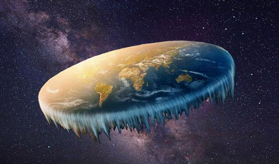
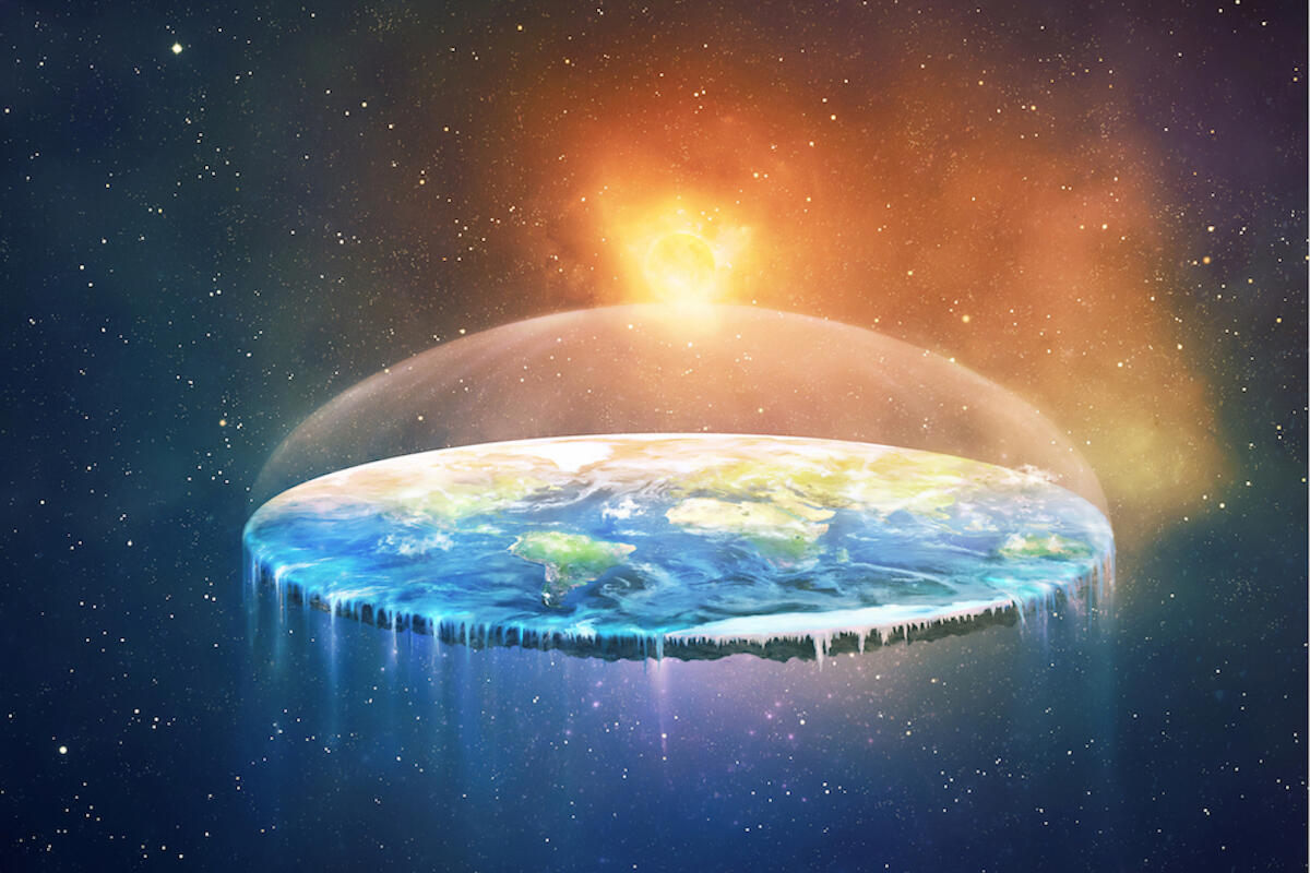
Let's start with these two. Here's one without a dome, and one with. They usually have a dome over the pizza, because they both believe that if there was no dome, the vacuum of space would suck all the air away, and also that there's no space, there's just the "upper waters" above the dome. It's hard to tell if this is a disagreement ('It is difficult with these evil folk to know when they are in league, and when they are cheating one another.') or cognitive dissonance. Can you have that without cognition?
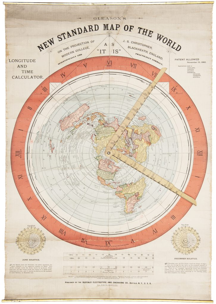
And then there's the Alexander Gleason map
They may claim that the logo of The United Nations is a flat-earth map, when it's just a polar projection
Now there are some versions with more seas and land. There's the supposed map found in a temple in Japan. Click on the link for more information about this hoax (TODO mention some of it here)
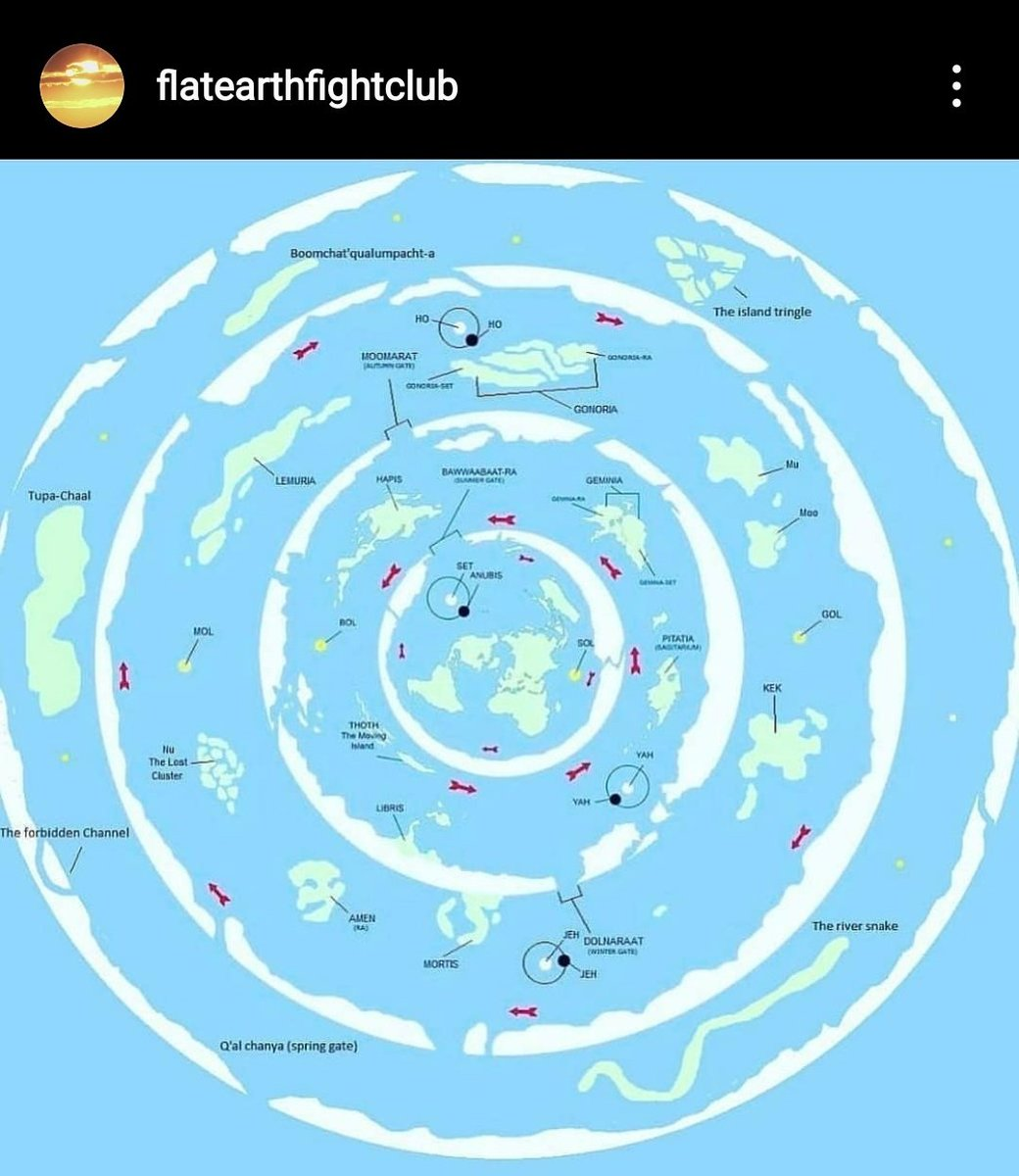
There are a few more recent versions showing concentric rings. Sometimes the features are given names and there may be extra suns and moons shown. The first image below is of course constantly circulated by flat-earthers but comes from DeviantArt, where the creator (not a flerf) wrote that he based it on the second (probably by one). Here's a link to that. Nothing is known about who drew the other ones, but they don't look like the one supposedly found in Japan.
Flerfs will sometimes say that Admiral Byrd reported that when he got to the South Pole, he saw "an area as big as the United States, that’s never been seen by a human being. And that’s beyond the pole, on the other side of the south pole" but that's just the other side of Antarctica, the area of the outer rings of these maps are many times larger than the area of the USA.
TODO Mention the scene in Beyond the Curve, maybe a screenshot with the physical model.
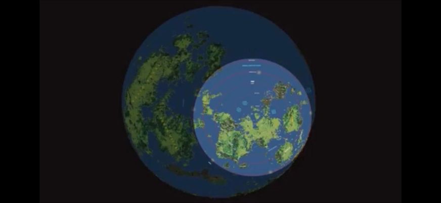
Finally, there's the idea of a very large Earth covered mostly in ice, with puddles, one of which is our Earth. Sometimes it's a large ball, other times it's flat. Where any of this comes from is also unknown. TODO see if it's possible to find out who invented this and write something about domes.
A variation on the huge sphere, but just an ice ring, says (according to Google Translate) "The planet Gaia is bigger than we all think. The topsoil is an area protected with a pom (it probably misread 'Dom', meaning dome) and an ice wall. (please see the area in the North Pole of Gaia in the picture)... See more" but we can't see more as it was posted without a link.
Searching for the German text, I found a post on Telegram where I was able to see the rest (and I was right about Dom) "The sun and moon are located within this 3D created artificial matrix. The Darkness has separated Mother Earth from all other areas of Gaia for over 320,000 years. Since then, we have lived together and separated in this area. We were explicitly separated and isolated from all other areas and their residents. The coming ascension will bring Mother Earth out of this isolation. The protective dome and the ice wall will collapse. Thousands of areas of Gaia will be accessible. A new era will totally change the future of all humanity."
Searching for the German text, I found a post on Telegram where I was able to see the rest (and I was right about Dom) "The sun and moon are located within this 3D created artificial matrix. The Darkness has separated Mother Earth from all other areas of Gaia for over 320,000 years. Since then, we have lived together and separated in this area. We were explicitly separated and isolated from all other areas and their residents. The coming ascension will bring Mother Earth out of this isolation. The protective dome and the ice wall will collapse. Thousands of areas of Gaia will be accessible. A new era will totally change the future of all humanity."
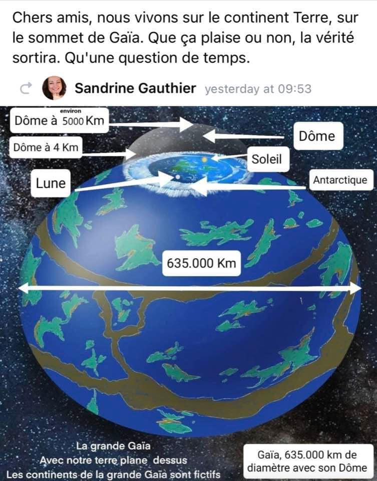
A French version adds some labels and measurements and says (Google Translate, again) "we live on the continent Earth, on the summit of Gaia. Like it or not, the truth will come out. Only a matter of time." and "The great Gaia, With our earth hovering above The continents of great Gaia are fictitious."
Here's an odd one. It sometimes circulates with text about "convex Earth".
And then there's this. It seems to be an attempt to claim that the features on the Moon reflect (poorly) the continents, including some made-up ones. It gets distributed with word-soup like "The moon is a focused electromagnetic phenomenon, called plasma. Cosmic electromagnetic energy comes below from the flat and stationary plane, going above. The inner reflection of this electromagnetic energy on
this field's ceiling, turns it back down, creating a focus spot point in a semi aetherial environment.
At this spot, there is fluorescence of the aether because of the focused cosmic electromagnetic energy. The spot that is created is the moon.(4th state of matter as specified publicly by the american
astrophysical professor Among R Foster in 1965) In this way, the Moon reveals to us the large part of the terrestrial and oceanic surface and with these natural characteristics serves as a natural map of Earth."
I recently found this, which was claimed to be from a higher resolution copy. It's at the bottom of the map, in the part outside the actual map of the continents.
And here is a higher resolution version. The area to the north the supposed Nazi UFO base is called New Schwabenland and has a second swastika on it. There is an actual region of Antarctica the Nazis claimed and gave this name to. The text still isn't clear enough for Google Lens to decode, or maybe the handwriting confuses it, but there seems to be a quote from the Book of Enoch, a diagram of the solar system, and an attempt to explain phases of the Moon.
I found screenshots of what may be an even clearer copy that someone was able to get a OCR/translator to almost understand.
Here's a version I found in a number of Facebook flat-earth groups. Aside from the added circles and arrows (without expiations) it was also cropped to remove the swastikas.
Then there's this one, where it looks like we Jews have defeated the Nazis in the hidden lands, and, I think, conquered both (?) suns. Hold on, there's one moon that reflects the continents, and two more that move around?
Places it was posted are: Flat Earth United, Flat Earth, two more groups with the same name, Flat Earth MEMEs, and Flat Earth Greece
Here's a video about the map. The narrator thinks it dates from World War II. Throughout, he blocks out the swastikas, afraid that showing or even naming them will cause YouTube to remove the video.
He also found a mousepad version of the map that someone sells, on which he managed to make out the name "Asgard" on one of the fictitious continents. Asgard also is labeled on some of the other multi-ring maps above.
He also found a higher resolution image of part of the map which has one region named Terra de Vista. It also shows Princess Elizabeth Land and Queen Maud Land, which in reality are in Antarctica.
And he also found an entirely new version. This one is in Portuguese, and as Brazil is marked with its flag, it probably comes from there. It has less places named than the German map, but those that are are legible. I found a copy of that elsewhere. Some of the swastikas have changed location, there's also a black sun, another Nazi symbol near Atlantis. A landmass between South Africa and New Zealand is named Mu, several Zodiac signs appear over concentric circles, I can't read it, but he says that the blurry red label over Russia says "Gog and Magog". At the bottom-right is the Prague astronomical clock, a flat-earth favorite because it predates Copernicus.
This channel also has a number of videos about the Nos Confunden map (in two paragraphs) and the maps showing lands beyond the ice wall (above). I suppose I'll have to eventually watch them ...
Here's a version I've just seen. I don't know how the Moon got larger in this one.
Here's a version I've just seen. I don't know how the Moon got larger in this one.
And then there's this, from a YouTube and Instagram channel that goes by the name Nos Confunden ("they confus us" in Spanish according to Google Translate). It is reportedly the work of Claudio Nocelli, the author of "TERRA-INFINITA, Extraterrestrial Worlds and Their Civilizations: The Story told by the Woman Who Was Born in the Lands Behind the Ice Walls" (May 2022, link to Goodreads) where he seems to have based it on Helen Morris and her father William Morris, who got the info from an unnamed "giant". There seems to be something on this channel claiming they, too, are from beyond the "ice wall", or perhaps Helen was born while her father was exploring. I don't know when this is alleged to have taken place, or how they got past the ice wall, or whether it was before or after the penguins began to guard it.
A flat-earther, looking at any of these, will probably insist "that's not what we believe" but when asked what they (singular or flat-earthers in general) will not respond with a map.
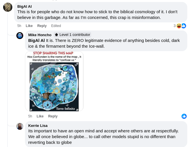
Once in a while, these models are even too much for flat-earthers. I found these comments in a private group called firmament trackers in response to one of the multiple-ring maps.










No comments:
Post a Comment