So this video was posted to Official Flat Earth & Globe Discussion.

So I watched the video. Here's my response.
One fisk, coming up So we've got a YTer who calls himself Immune2BS. On first thought, is he also an anti-vaxxer? Well looking at the rest of his channel it would seem no, he's a one-conspiracy guy. So let's hear what he has to say.
He says he will explain why the Gleason map is accurate. He compares Australia on Gleason and Google Earth, or the globe if you will. They look different (we noticed). But the features of Australia are the same on each map, and he points to something near the Tropic of Capricorn meets the west coast of Australia, and everything has the same coordinates (yes, Gleason has the same coordinates for everything, it wouldn't even be a map projection were that not true). And the same thing happens where the tropic "exits out" on the west coast (he sounds surprised). And this also works where 135°E meets the south coast. How can that be?
Gleason looks like a clock and there's that think in the center that moves and indicates latitude. He superimposes circles every 15° from the North Pole (but takes a lot longer to say that, because he mentions the value of every stop from 90°N to 60°S when there's a skidding sound) Whoa! What happened here? There's more Earth the further south you get, and "when somebody decided to create a globe out of the flat earth" they had to elongate and stretch to make it work because there's 15° missing of latitude.
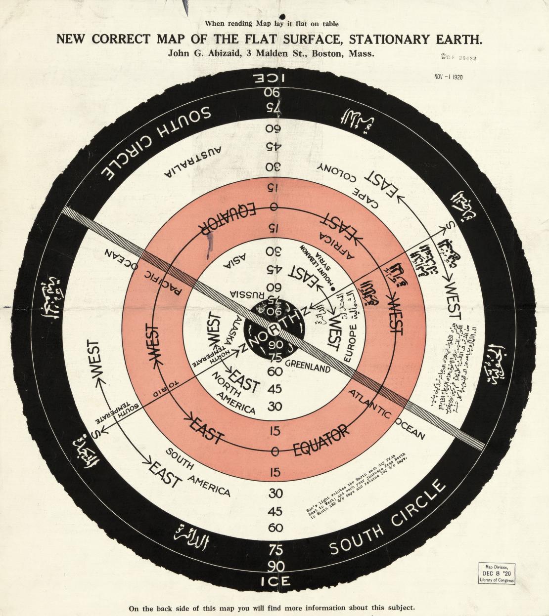
(I really don't know what he's going on about, 75°S is on the Gleason map. I listened to that part twice to make sure he was saying it. The lines of latitude aren't marked around Australia, but they are along the line of longitude that runs thru Greenland, which Gleason labeled 2PM. 75°S passed thru Antarctica on both his map and on the globe as well as any other projection on a map., see image below, it's from a better image of the map, but the very same map with the Boston Public Library stamp on at 3PM it that I found online. And it's hard to see in the blurry image that YouTube displays, but HIS map also has the same numbers at 2PM, he just didn't notice them)
From what he can tell, and this is just conjecture (his word) they started from the top, the North Pole area and everything got stretched as they got down to the quote unquote South Pole. Everything about this map makes sense. It is a clock and so is the world because the day is 24 hours. Even time zones make sense. He shows an image of the actual time zones and asks which makes more sense, that or this (but fails to explain why he thinks Gleason makes more sense).


Now he switches to a map made by someone called Tiger Dan (this video was made in 2016 so perhaps people who followed this debate then knew what this was, all I can tell is it has some airport codes added to it and Mr. BS calls it a fiasco) but it looks like Dan tried to make landmasses from a globe or some other projection work on a Gleason map.
Then there's someone named Brian Clark who supposedly found a flat earth map from 1920 in the Library of Congress (supposedly? Here it is on the Library of Congress site and it has latitude lines all the way out to 90 (once again, so does Gleason, but what's he saying, the LoC map was faked?).
No comments:
Post a Comment